In LITHOPROBE, geochronology is important in
providing the detailed age control for surface rocks and intrusives
that is essential to unravelling their local geological history.
Isotopic dating is critically important where organic material and
fossils are absent (as in most Precambrian settings) and is the
only means that can securely establish timing of the intrusions
and metamorphism that are associated with tectonic activity.
Dating of surface exposures is required to connect the observed
rocks with the geophysically-determined geometry and domains at
depth.
Isotopic geochronometric studies are planned along all transects
to date the emplacement of all significant granitic and volcanic
suites and the times of their metamorphism and deformation. Dates
by several methods, including fission track counting, are used to
establish times and rates of uplift of the metamorphic and plutonic
rocks and basin deposits. World-class facilities for these studies
exist at a number of Canadian universities, the GSC and the Royal
Ontario Museum.
Paleomagnetism
The techniques of paleomagnetism are based on measuring the directions
of magnetization "frozen" into rock formations having
minute quantities of iron at their time of origin (time of solidification)
or at subsequent times when they have been reheated or metamorphosed.
By making careful corrections for the present attitude of a rock
formation (how it has been folded or tilted) and comparing these
directions with the known magnetic field at the time of their magnetization,
it is possible to calculate the original latitude of the rocks.
The unravelling of the movements through geological time of terranes
and continents from the record of the Earth's magnetic field contained
in appropriate rocks is a complex process. However, paleomagnetic
studies have had remarkable success in providing the framework for
measuring continental drift and plate tectonic movements and contributing
to the ultimate proof that such movements have occurred.
In recent years, a major achievement of paleomagnetism has been
the measurement and confirmation of the complex assemblage processes
that have occurred in the western Cordillera. These are now seen
to have involved major latitudinal shifts (indicating up to thousands
of kilometres of movement) and block rotations. Although fossil
assemblages and facies have been important in providing other geological
evidence for these movements, paleomagnetism offers the opportunity
for direct measurement. Determination of the latitude of origin
of rock formations and, in particular, that certain rock formations
now juxtaposed may have had origins many hundreds or thousands of
kilometres apart, is critically important in understanding the geotectonic
developments within a transect and thus the evolution of the continent.
Paleomagnetic field work involves field sampling of the selected
rock types with close geological control (rock unit, age, attitude).
Knowing the age of the rock, either from geochronology or fossil
control, is critical. Notice how the different disciplines must
interact to be effective.
Physical Properties of Rocks
All geophysical observations relate in some way to the physical
properties of rocks - seismic to compressional and shear velocities,
gravity to density, magnetic to magnetic susceptibility, electromagnetic
to porosity and electrical conductivity, geothermal to thermal conductivity
and heat production, and paleomagnetism to various types of magnetization
associated with rocks. Some of these properties must be determined
as a requirement of the method itself; others are determined independently.
Geophysical logging of boreholes made available by the mining industry
can provide valuable information where this is applicable.
In many cases, it is important to determine physical rock properties
under in situ conditions of temperature, pressure and fluid content.
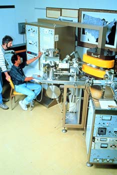
This requires specialized and complex equipment so that only a few
laboratories in universities have appropriate capabilities. The
appropriate rock samples are selected in the field usually with
the collaboration of a mapping geologist, or are obtained from cores
or cuttings from boreholes of opportunity from either the mining
or petroleum industry. Particular success has been achieved in relating
physical rock properties derived from borehole studies to seismic
and electromagnetic data in mining areas.
For LITHOPROBE and other research, access to information about
physical properties of a wide variety of rock types under varying
conditions is highly valuable.
Summary on Earth Science Disciplines
Now that you’ve had a “crash course” on earth
science methods, you’ll probably appreciate what efforts we
must make to try to understand the structure and evolution of the
very continent we live on. On its own, not one of these disciplines
could provide sufficient information to even begin our understanding.
But put them all together, along with the knowledge of the scientists
who apply the methods, and then real scientific progress and understanding
can be developed.
We hope that you have found our story on “Probing the Lithosphere”
a fascinating one, and that in so doing you have even learned something.
LITHOPROBE is acknowledged as the premier multidisciplinary earth
science program operating on any continent or in any country. Canadians
can be proud of our contribution to earth science and to understanding
the very evolution of the land on which we live.
|