lithoprobe logo
 
home | contact | search about | transects | publications | links | classroom/media 


LITHOPROBE Techniques


media > slideset > the Growth of Canada >
 

Base map of the Newfoundland Appalachians showing tectonostratigraphic zonation, simplified surface geology, and the location of the three seismic reflection corridors (numbered black lines) used by LITHOPROBE.

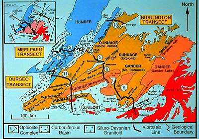
There also is a portion of this mountain belt in West Africa, namely that missing eastern part of eastern Newfoundland whose parentage makes it African. That's what happens when you get into global-scale splitting. By the way, the central portion of Newfoundland is oceanic in origin (remember the Iapetus ocean?), and the western third North American.

previous page next image
home | about | transects | publications | links | classroom/media | search | contact